
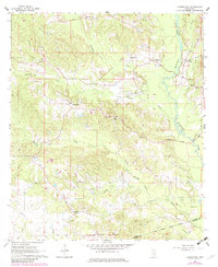
1964 Map of Carmichael
USGS Topo · Published 1965About this map
Carmichael Oil Field and the West Langsdale Oil Field define the industrial footprint of this Clarke County landscape during the mid-1960s. Scattered with active Oil Wells and a Drill Hole, the area shows a clear transition from timber and turpentine to petroleum extraction. The terrain is deeply carved by the meandering Bucatunna Creek and its many tributaries like Fivemile Creek and Hanging Moss Creek, which provided natural drainage for the small settlements of Carmichael, Langsdale, and Theadville.
Find a feature on this map
46 named features on this map. Tap any name to fly to it.
Don’t see what you’re looking for? This feature index may not catch every label — zoom into the map to look around manually.
Map Details
Editions of this 1964 Carmichael Map
2 editions found
Other maps of this area

1953 · Hattiesburg
USGS Topo · 1:250,000

1953 · Meridian
USGS Topo · 1:250,000

1957 · Meridian
USGS Topo · 1:250,000

1957 · Quitman
USGS Topo · 1:62,500

1958 · Hattiesburg
USGS Topo · 1:250,000

1964 · De Soto
USGS Topo · 1:24,000

1964 · Shubuta
USGS Topo · 1:24,000

1964 · Matherville
USGS Topo · 1:24,000

1965 · Meridian
USGS Topo · 1:250,000

1974 · Melvin
USGS Topo · 1:24,000