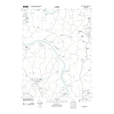
2010 Map of Carmichaels
USGS Topo · Published 2010About this map
The Monongahela River carves a deep path through this Fayette County landscape, anchoring a network of coal-patch towns and riverside settlements. Along the eastern banks, industrial history is etched into the terrain at Crucible and Isabella, while the western shore reveals the established community of Carmichaels and the large footprint of Nemacolin. The map preserves the specific locations of early mining outposts like Tower Hill Number Two and Thompson Number 1, alongside family-named landmarks such as Horner Cemetery and Laurel Hill Cemetery. Transportation patterns are dictated by the river and numerous hollows, with older routes like Old Ferry Rd and Jacobs Ferry Rd hinting at the historical river crossings that once linked these communities. To the north, the massive Labelle Slurry Pond Three Dam stands as a significant industrial landmark near Luzerne.
Find a feature on this map
114 named features on this map. Tap any name to fly to it.
Don’t see what you’re looking for? This feature index may not catch every label — zoom into the map to look around manually.
Map Details
Editions of this 2010 Carmichaels Map
This is the sole edition of this map. No revisions or reprints were ever made.
Other maps of this area

1900 · Masontown
USGS Topo · 1:62,500

1901 · Amity
USGS Topo · 1:62,500

1901 · Waynesburg
USGS Topo · 1:62,500

1902 · Brownsville
USGS Topo · 1:62,500

1903 · Masontown
USGS Topo · 1:62,500

1904 · Amity
USGS Topo · 1:62,500

1904 · Waynesburg
USGS Topo · 1:62,500

1906 · Brownsville
USGS Topo · 1:62,500

1931 · Brownsville
USGS Topo · 1:62,500

1931 · Masontown
USGS Topo · 1:62,500