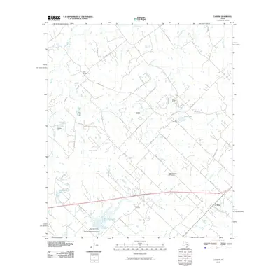
2010 Map of Carmine
USGS Topo · Published 2010About this map
The crossroads of Carmine and the settlement of La Bahia anchor this detailed study of eastern Fayette County. The landscape is defined by its water management and agricultural heritage, featuring multiple reservoirs such as Schoenberg Lake, Moye Lake, and the large Soil Conservation Service Site 7 Reservoir. These engineered water bodies, often accompanied by structures like the Moye Lake Dam, illustrate the 20th-century transition toward soil and water conservation in rural Texas.
Find a feature on this map
62 named features on this map. Tap any name to fly to it.
Don’t see what you’re looking for? This feature index may not catch every label — zoom into the map to look around manually.
Map Details
Editions of this 2010 Carmine Map
This is the sole edition of this map. No revisions or reprints were ever made.
Other maps of this area

1919 · Giddings
USGS Topo · 1:62,500

1919 · Dime Box
USGS Topo · 1:62,500

1954 · Austin
USGS Topo · 1:250,000

1956 · Somerville
USGS Topo · 1:62,500

1958 · Ledbetter
USGS Topo · 1:24,000

1958 · Greenvine
USGS Topo · 1:24,000
1958 · Nechanitz
USGS Topo · 1:24,000

1958 · Carmine
USGS Topo · 1:24,000

1958 · Burton
USGS Topo · 1:24,000
1958 · Round Top
USGS Topo · 1:24,000