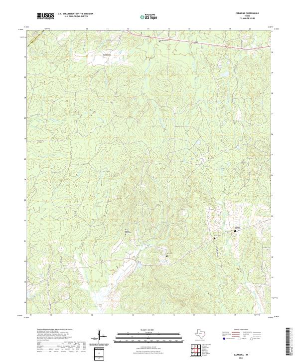
2022 Map of Carmona
USGS Topo · Published 2022About this map
Carmona sits at the northern edge of this East Texas landscape, where the headwaters of numerous creeks begin their descent through the piney woods. The area is defined by a dense network of seasonal and perennial waterways, including White Oak Cr, Salt Cr, and Rocky Cr, which carve a rolling topography through the terrain. Evidence of long-standing family settlements is scattered throughout the region, preserved in the form of small, isolated burial grounds like the Rowe - Dunham Family Cem and the Holhausen - Darby Cem.
Find a feature on this map
36 named features on this map. Tap any name to fly to it.
Don’t see what you’re looking for? This feature index may not catch every label — zoom into the map to look around manually.
Map Details
Editions of this 2022 Carmona Map
This is the sole edition of this map. No revisions or reprints were ever made.
Other maps of this area

1953 · Palestine
USGS Topo · 1:250,000

1954 · Beaumont
USGS Topo · 1:250,000

1955 · New Willard
USGS Topo · 1:62,500

1957 · Beaumont
USGS Topo · 1:250,000

1957 · Palestine
USGS Topo · 1:250,000

1960 · Colita
USGS Topo · 1:24,000

1961 · Onalaska
USGS Topo · 1:24,000

1963 · Groveton East
USGS Topo · 1:24,000
1963 · Trevat
USGS Topo · 1:24,000
1963 · Wakefield
USGS Topo · 1:24,000