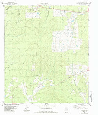
1984 Map of Carmona
USGS Topo · Published 1984About this map
The boundary between Trinity County and Polk County cuts through this East Texas landscape, where small settlements like Carmona and Eden are connected by a network of local roads and natural drainage systems. The area is characterized by a high density of family and community burial grounds, including the Rowe-Dunham Cem, Kent Cem, Holcomb Cem, and Holhousen-Darby Cem. These sites, along with the Carmona Ch, provide significant touchpoints for genealogical research in this rural corridor.
Find a feature on this map
25 named features on this map. Tap any name to fly to it.
Don’t see what you’re looking for? This feature index may not catch every label — zoom into the map to look around manually.
Map Details
Editions of this 1984 Carmona Map
This is the sole edition of this map. No revisions or reprints were ever made.
Other maps of this area

1953 · Palestine
USGS Topo · 1:250,000

1954 · Beaumont
USGS Topo · 1:250,000

1955 · New Willard
USGS Topo · 1:62,500

1957 · Beaumont
USGS Topo · 1:250,000

1957 · Palestine
USGS Topo · 1:250,000

1960 · Colita
USGS Topo · 1:24,000

1961 · Onalaska
USGS Topo · 1:24,000

1963 · Groveton East
USGS Topo · 1:24,000
1963 · Trevat
USGS Topo · 1:24,000
1963 · Wakefield
USGS Topo · 1:24,000