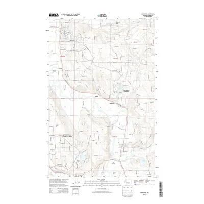
2014 Map of Carnation
USGS Topo · Published 2014About this map
The Snoqualmie River winds through this 2014 survey of King County, defining a valley of agriculture and growing residential pockets. The river is the central artery for the region, bordered by landmark sites such as Carnation Farm and the recreation-oriented Camp Gilead. To the north, the town of Duvall sits near the confluence of Cherry Creek, while the city of Carnation anchors the southern portion of the map where the Tolt River meets the Snoqualmie. The landscape transitions from the flatlands of Cherry Valley to the elevated terrain of Tolt Hill and Novelty Hill. Water features are abundant across the plateaus, including Lake Marcel, Ames Lake, and the small Ames Lake Pothole. This modern topographic study illustrates the contemporary road network, including Carnation Duvall Road NE, which connects the historic riverfront settlements.
Find a feature on this map
118 named features on this map. Tap any name to fly to it.
Don’t see what you’re looking for? This feature index may not catch every label — zoom into the map to look around manually.
Map Details
Editions of this 2014 Carnation Map
This is the sole edition of this map. No revisions or reprints were ever made.
Other maps of this area

1895 · Snohomish
USGS Topo · 1:125,000

1897 · Seattle
USGS Topo · 1:125,000

1921 · Sultan
USGS Topo · 1:125,000

1923 · Sultan
USGS Topo · 1:125,000

1944 · Everett
USGS Topo · 1:62,500

1950 · Redmond
USGS Topo · 1:24,000

1950 · Issaquah
USGS Topo · 1:24,000

1953 · Snoqualmie
USGS Topo · 1:24,000

1953 · Sultan
USGS Topo · 1:24,000

1953 · Lake Joy
USGS Topo · 1:24,000