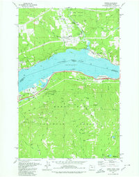
1979 Map of Carnation
USGS Topo · Published 1980About this map
The Columbia River serves as the central artery for this late 1970s landscape, dividing the Gifford Pinchot National Forest in Washington from the Mount Hood National Forest in Oregon. The settlement of Carson stands out as a hub of activity north of the river, while smaller communities like Home Valley and Wyeth flank the water's edge. This era shows a complex mix of conservation and transit, with the Burlington Northern railroad and Pacific Highway 80N facilitating movement through the gorge.
Find a feature on this map
79 named features on this map. Tap any name to fly to it.
Don’t see what you’re looking for? This feature index may not catch every label — zoom into the map to look around manually.
Map Details
Editions of this 1979 Carnation Map
This is the sole edition of this map. No revisions or reprints were ever made.
Other maps of this area

1895 · Snohomish
USGS Topo · 1:125,000

1897 · Seattle
USGS Topo · 1:125,000

1921 · Sultan
USGS Topo · 1:125,000

1923 · Sultan
USGS Topo · 1:125,000

1944 · Everett
USGS Topo · 1:62,500

1950 · Redmond
USGS Topo · 1:24,000

1950 · Issaquah
USGS Topo · 1:24,000

1953 · Snoqualmie
USGS Topo · 1:24,000

1953 · Sultan
USGS Topo · 1:24,000

1953 · Lake Joy
USGS Topo · 1:24,000