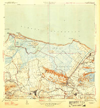
1947 Map of Carolina
USGS Topo · Published 1947About this map
Carolina and its surrounding sugar-producing hinterlands are detailed in this survey conducted just before mid-century. The landscape is dominated by the industrial presence of Central Victoria, while numerous agricultural colonies like Colonia Las Mercedes and Colonia Santa Barbara are scattered across the alluvial plains. The map reveals the intricate water network essential to the region, from the winding Río Grande de Loíza to the marshy expanses of the Bosque Insular de Piñones. Along the coast, the transition from the Océano Atlántico to inland lagoons is marked by features such as Boca de Cangrejos and the Laguna de Piñones. Notable local landmarks include the Escuela Segunda Unidad de San Antón and the coastal settlement of Loíza Aldea, providing a clear record of the area's development before the rapid modernization of the late 20th century.
Find a feature on this map
61 named features on this map. Tap any name to fly to it.
Don’t see what you’re looking for? This feature index may not catch every label — zoom into the map to look around manually.
Map Details
Editions of this 1947 Carolina Map
3 editions found
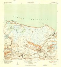
Other maps of this area

1940 · Carolina
USGS Topo · 1:30,000

1941 · San Juan
USGS Topo · 1:30,000

1941 · Rio Grande
USGS Topo · 1:30,000

1941 · Carolina
USGS Topo · 1:30,000

1945 · El Yunque
USGS Topo · 1:30,000

1946 · El Yunque
USGS Topo · 1:30,000

1946 · Aguas Buenas
USGS Topo · 1:30,000

1946 · Gurabo
USGS Topo · 1:30,000

1947 · Carolina
USGS Topo · 1:30,000

1947 · Gurabo NE
USGS Topo · 1:10,000