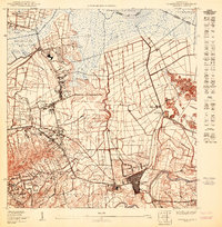
1950 Map of Carolina SO
USGS Topo · Published 1950About this map
Central Victoria and the urban grid of Carolina anchor this 1950 topographical study, capturing the region during a pivotal era of infrastructure development. The transition from agricultural sugar production to modern aviation is evident in the planned footprint of the Aeropuerto Internacional (Proyecto) near the northern coastline. Dense settlements like Poblado Sabana Abajo and family-centered landmarks such as the Escuela Segunda Unidad de San Antón reflect the local social fabric before massive mid-century urbanization.
Find a feature on this map
33 named features on this map. Tap any name to fly to it.
Don’t see what you’re looking for? This feature index may not catch every label — zoom into the map to look around manually.
Map Details
Editions of this 1950 Carolina SO Map
This is the sole edition of this map. No revisions or reprints were ever made.
Other maps of this area

1940 · Carolina
USGS Topo · 1:30,000

1941 · San Juan
USGS Topo · 1:30,000

1941 · Carolina
USGS Topo · 1:30,000

1946 · Aguas Buenas
USGS Topo · 1:30,000

1946 · Gurabo
USGS Topo · 1:30,000

1947 · Carolina
USGS Topo · 1:30,000

1947 · Gurabo NE
USGS Topo · 1:10,000
1947 · Aguas Buenas NE
USGS Topo · 1:10,000
1947 · San Juan
USGS Topo · 1:30,000
1949 · Carolina NE
USGS Topo · 1:10,000