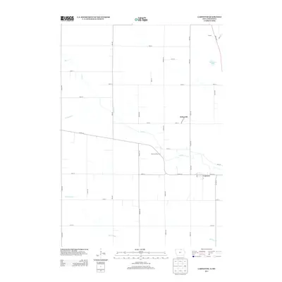
2013 Map of Carpenter
USGS Topo · Published 2013About this map
Carpenter and Meltonville anchor this northern Mitchell County landscape just south of the Minnesota border. The terrain is defined by the winding course of Deer Cr and its tributaries, reflecting the agricultural character of the region. Local water features like Markhams Pond and Willow Cr dot the landscape, alongside engineered improvements such as Ditch Number 11. Transportation is a central theme, with the Deer Creek Rest Area situated along CO Hwy-105 and a grid of rural roads like Vine Ave and Warbler Ave providing access to outlying farms. The settlement at Otranto appears in the northeast, connected by the local road network that has supported the area's farming economy for generations.
Find a feature on this map
36 named features on this map. Tap any name to fly to it.
Don’t see what you’re looking for? This feature index may not catch every label — zoom into the map to look around manually.
Map Details
Editions of this 2013 Carpenter Map
This is the sole edition of this map. No revisions or reprints were ever made.
Other maps of this area

1954 · Hayward
USGS Topo · 1:62,500

1954 · Austin
USGS Topo · 1:62,500

1954 · Mason City
USGS Topo · 1:250,000

1957 · Mason City
USGS Topo · 1:250,000

1958 · Mason City
USGS Topo · 1:250,000

1972 · St. Ansgar
USGS Topo · 1:24,000

1972 · Osage SW
USGS Topo · 1:24,000

1972 · Manly
USGS Topo · 1:24,000

1972 · Northwood
USGS Topo · 1:24,000
1972 · Grafton
USGS Topo · 1:24,000