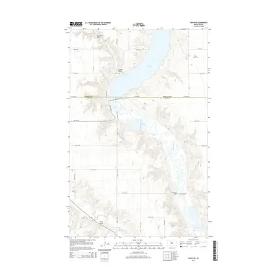
2014 Map of Carpio NE
USGS Topo · Published 2014About this map
Lake Darling and the winding Souris River dominate this 2014 survey of the borderlands between Renville and Ward counties. The landscape is defined by the significant hydrology of the northern plains, where the Des Lacs River cuts across the southwestern corner and several coulees, including Mackobee Coulee and Blacks Coulee, drain into the river valleys. Local heritage is preserved at Saint Henrys Cem and Valla Cem, while the modern recreational and ecological value of the area is highlighted by the Pelican Nature Trail and various managed ponds. The crossing at Saint Marys Bridge provides a vital link across the wetlands and river channels that characterize this rural North Dakota terrain.
Find a feature on this map
21 named features on this map. Tap any name to fly to it.
Don’t see what you’re looking for? This feature index may not catch every label — zoom into the map to look around manually.
Map Details
Editions of this 2014 Carpio NE Map
This is the sole edition of this map. No revisions or reprints were ever made.
Other maps of this area

1948 · Burlington
USGS Topo · 1:24,000

1948 · Lansford
USGS Topo · 1:62,500

1948 · Burlington
USGS Topo · 1:62,500

1948 · Lansford SW
USGS Topo · 1:24,000

1949 · Burlington NW
USGS Topo · 1:24,000

1949 · Lansford SW
USGS Topo · 1:24,000

1949 · Carpio NE
USGS Topo · 1:24,000

1949 · Carpio
USGS Topo · 1:24,000

1949 · Grano SW
USGS Topo · 1:24,000

1949 · Grano
USGS Topo · 1:24,000