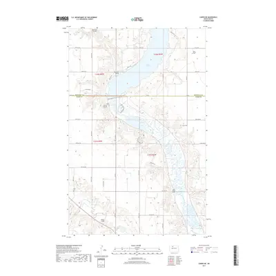
2017 Map of Carpio NE
USGS Topo · Published 2017About this map
Lake Darling dominates the northern reaches of this Ward County landscape, where the waters of the Souris River are managed through a series of containment areas including Pond A, Pond B, and Pond C. The map documents a highly structured riparian environment, featuring recreational infrastructure such as the Overlook Viewing Trail, Oxbow Nature Trail, and Cottonwood Nature Trail that navigate the river's winding path. This 2017 survey illustrates the intersection of modern conservation and historic land divisions, marked by the Renville Co Ward Co boundary line. Local history is anchored by the presence of Saint Henrys Cem in the northeast and Valla Cem to the southwest. The Des Lacs River cuts through the lower portion of the sheet near Blacks Coulee, while Saint Marys Bridge provides a key crossing point for researchers tracing the development of rural infrastructure in this part of North Dakota.
Find a feature on this map
30 named features on this map. Tap any name to fly to it.
Don’t see what you’re looking for? This feature index may not catch every label — zoom into the map to look around manually.
Map Details
Editions of this 2017 Carpio NE Map
This is the sole edition of this map. No revisions or reprints were ever made.
Other maps of this area

1948 · Burlington
USGS Topo · 1:24,000

1948 · Lansford
USGS Topo · 1:62,500

1948 · Burlington
USGS Topo · 1:62,500

1948 · Lansford SW
USGS Topo · 1:24,000

1949 · Burlington NW
USGS Topo · 1:24,000

1949 · Lansford SW
USGS Topo · 1:24,000

1949 · Carpio NE
USGS Topo · 1:24,000

1949 · Carpio
USGS Topo · 1:24,000

1949 · Grano SW
USGS Topo · 1:24,000

1949 · Grano
USGS Topo · 1:24,000