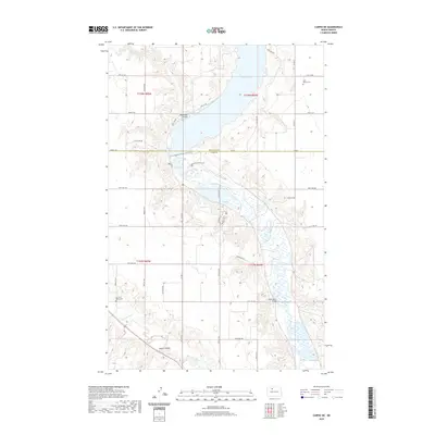
2020 Map of Carpio NE
USGS Topo · Published 2020About this map
Lake Darling and the Souris River valley dominate this landscape along the border of Renville County and Ward County. The topography is defined by the winding river systems and seasonal water bodies like Pond A and Pond B, which are fed by drainage features including Mackobee Coulée and Blacks Coulee. Cultural landmarks are centered on historical points of gathering and rest, such as Saint Henrys Cem in the northeast and Des Lacs Valley Cem near the Des Lacs River in the southwest.
Find a feature on this map
40 named features on this map. Tap any name to fly to it.
Don’t see what you’re looking for? This feature index may not catch every label — zoom into the map to look around manually.
Map Details
Editions of this 2020 Carpio NE Map
This is the sole edition of this map. No revisions or reprints were ever made.
Other maps of this area

1948 · Burlington
USGS Topo · 1:24,000

1948 · Lansford
USGS Topo · 1:62,500

1948 · Burlington
USGS Topo · 1:62,500

1948 · Lansford SW
USGS Topo · 1:24,000

1949 · Burlington NW
USGS Topo · 1:24,000

1949 · Lansford SW
USGS Topo · 1:24,000

1949 · Carpio NE
USGS Topo · 1:24,000

1949 · Carpio
USGS Topo · 1:24,000

1949 · Grano SW
USGS Topo · 1:24,000

1949 · Grano
USGS Topo · 1:24,000