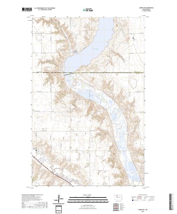
2024 Map of Carpio NE
USGS Topo · Published 2024About this map
Upper Souris National Wildlife Refuge dominates the central corridor of this North Dakota landscape, preserving the riparian ecosystem where the Souris River flows south from Lake Darling. The map illustrates a complex network of wetlands and managed water bodies, including Pond A and Pond B, which are fed by prairie tributaries like Mackobee Coulee. The topography is defined by the distinct valleys of two major waterways, as the Des Lacs River cuts through the southwestern corner of the quadrangle near Blacks Coulee.
Find a feature on this map
26 named features on this map. Tap any name to fly to it.
Don’t see what you’re looking for? This feature index may not catch every label — zoom into the map to look around manually.
Map Details
Editions of this 2024 Carpio NE Map
This is the sole edition of this map. No revisions or reprints were ever made.
Other maps of this area

1948 · Burlington
USGS Topo · 1:24,000

1948 · Lansford
USGS Topo · 1:62,500

1948 · Burlington
USGS Topo · 1:62,500

1948 · Lansford SW
USGS Topo · 1:24,000

1949 · Burlington NW
USGS Topo · 1:24,000

1949 · Lansford SW
USGS Topo · 1:24,000

1949 · Carpio NE
USGS Topo · 1:24,000

1949 · Carpio
USGS Topo · 1:24,000

1949 · Grano SW
USGS Topo · 1:24,000

1949 · Grano
USGS Topo · 1:24,000