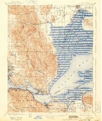
1901 Map of Carquinez
USGS Topo · Published 1943About this map
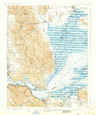
Benicia and the U.S. Arsenal anchor this late-nineteenth-century survey of the critical waterways connecting the California coast to the interior. The landscape is defined by the complex hydrology of Suisun Bay and the Carquinez Strait, where a dense network of tidal channels like Peytonia Slough and Montezuma Slough weave around Grizzly Island. The map captures the industrial and maritime character of the region before mid-century development, showing the established waterfronts of Vallejo and South Vallejo alongside growing rail-dependent towns.
Find a feature on this map
92 named features on this map. Tap any name to fly to it.
Don’t see what you’re looking for? This feature index may not catch every label — zoom into the map to look around manually.
Map Details
Editions of this 1901 Carquinez Map
6 editions found
Other maps of this area

1895 · San Francisco
USGS Topo · 1:62,500

1896 · Carquinez Strait
USGS Topo · 1:62,500

1896 · Mt. Diablo
USGS Topo · 1:62,500

1897 · Concord
USGS Topo · 1:62,500

1898 · Karquines
USGS Topo · 1:62,500

1898 · Mt. Diablo
USGS Topo · 1:62,500

1899 · San Francisco
USGS Topo · 1:62,500

1901 · Karquines
USGS Topo · 1:62,500

1902 · Napa
USGS Topo · 1:125,000

1907 · Antioch
USGS Topo · 1:62,500