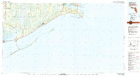
1978 Map of Carrabelle
USGS Topo · Published 1980About this map
Tates Hell Swamp and the dense woodlands of the Apalachicola National Forest dominate the interior of this coastal Florida survey. The landscape is defined by the complex hydrological network where the Apalachicola River, New River, and Ochlockonee River meet the sea. Coastal settlements like Carrabelle and Apalachicola serve as anchors for the local economy, connected by the Intracoastal Waterway and the John Gorrie Memorial Bridge.
Find a feature on this map
53 named features on this map. Tap any name to fly to it.
Don’t see what you’re looking for? This feature index may not catch every label — zoom into the map to look around manually.
Map Details
Editions of this 1978 Carrabelle Map
4 editions found
Other maps of this area

1940 · Arran
USGS Topo · 1:62,500

1943 · Arran
USGS Topo · 1:62,500

1943 · Dog Island
USGS Topo · 1:31,680

1943 · West Pass
USGS Topo · 1:31,680

1943 · Apalachicola
USGS Topo · 1:31,680

1943 · Carrabelle
USGS Topo · 1:24,000

1943 · St. Teresa Beach
USGS Topo · 1:24,000

1943 · Jackson River
USGS Topo · 1:24,000

1943 · Lighthouse Point
USGS Topo · 1:24,000

1944 · Pickett Bay
USGS Topo · 1:31,680