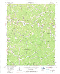
1954 Map of Carrie
USGS Topo · Published 1989About this map
Troublesome Creek winds through the heart of this mountain landscape, its path defining the development of small communities across the Knott and Perry county line in the mid-1950s. The map reveals a dense network of rural infrastructure, where nearly every significant hollow and fork supports its own local institution, such as the Lower Balls Fork Sch and the Ode Everage Sch. Settlements like Fisty, Emmalena, and Bearville are connected by a web of narrow branches and creeks including Montgomery Creek and Clear Creek. The inclusion of a Strip Mine and various cemeteries like Clear Creek Cem provides a clear record of the local economy and genealogy. From the Maggie Memorial Ch in the northeast to Hardburly in the west, the map documents a traditional Kentucky mountain society organized around its complex drainage system.
Find a feature on this map
88 named features on this map. Tap any name to fly to it.
Don’t see what you’re looking for? This feature index may not catch every label — zoom into the map to look around manually.
Map Details
Editions of this 1954 Carrie Map
4 editions found
Other maps of this area

1890 · Whitesburg
USGS Topo · 1:125,000

1891 · Hazard
USGS Topo · 1:125,000

1892 · Whitesburg
USGS Topo · 1:125,000

1912 · Hindman
USGS Topo · 1:48,000

1913 · Oven Fork
USGS Topo · 1:48,000

1914 · Troublesome
USGS Topo · 1:62,500

1915 · Hindman
USGS Topo · 1:62,500

1915 · Whitesburg
USGS Topo · 1:62,500

1916 · Cornettsville
USGS Topo · 1:62,500

1954 · Noble
USGS Topo · 1:24,000