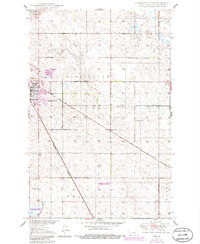
1950 Map of Carrington East
USGS Topo · Published 1986About this map
Carrington serves as the focal point of this Foster County landscape, situated at a significant rail junction during the mid-20th century. The town's infrastructure is well-defined, showing the Carrington Water Works and Carrington Cem on its outskirts. The intersection of the Soo Line and the Burlington Northern railroads dictates the local geography, cutting diagonally across the prairie and providing a vital link for the regional agricultural economy.
Find a feature on this map
14 named features on this map. Tap any name to fly to it.
Don’t see what you’re looking for? This feature index may not catch every label — zoom into the map to look around manually.
Map Details
Editions of this 1950 Carrington East Map
2 editions found
Other maps of this area

1900 · Pingree
USGS Topo · 1:125,000

1944 · Brantford
USGS Topo · 1:62,500

1946 · Brantford
USGS Topo · 1:62,500

1948 · New Rockford
USGS Topo · 1:62,500

1948 · Carrington
USGS Topo · 1:62,500

1950 · Carrington East
USGS Topo · 1:24,000

1950 · Melville
USGS Topo · 1:24,000

1950 · Brantford
USGS Topo · 1:24,000
1950 · New Rockford SE
USGS Topo · 1:24,000

1950 · Barlow
USGS Topo · 1:24,000