
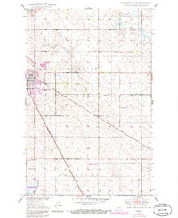
1950 Map of Carrington East
USGS Topo · Published 1950About this map
The city of Carrington serves as a significant rail junction at mid-century, where the Northern Pacific and the Minneapolis St Paul and Sault Ste Marie railroads intersect. This 1950 survey, developed as part of the Department of the Interior's Missouri River Basin program, captures the agricultural landscape of Foster County. The township grid is dotted with small-scale educational landmarks like School No 1 and School No 4, reflecting the rural school system of the era. North of the city, the Carrington Water Works and Sewage Disposal facility sit near Scotts Slough, indicating early municipal infrastructure. To the west, the Carrington Cem provides a point of interest for genealogists tracing local families during this period of North Dakota's development.
Find a feature on this map
11 named features on this map. Tap any name to fly to it.
Don’t see what you’re looking for? This feature index may not catch every label — zoom into the map to look around manually.
Map Details
Editions of this 1950 Carrington East Map
2 editions found
Other maps of this area

1900 · Pingree
USGS Topo · 1:125,000

1944 · Brantford
USGS Topo · 1:62,500

1946 · Brantford
USGS Topo · 1:62,500

1948 · New Rockford
USGS Topo · 1:62,500

1948 · Carrington
USGS Topo · 1:62,500

1950 · Melville
USGS Topo · 1:24,000

1950 · Brantford
USGS Topo · 1:24,000
1950 · New Rockford SE
USGS Topo · 1:24,000

1950 · Barlow
USGS Topo · 1:24,000

1950 · Carrington SW
USGS Topo · 1:24,000