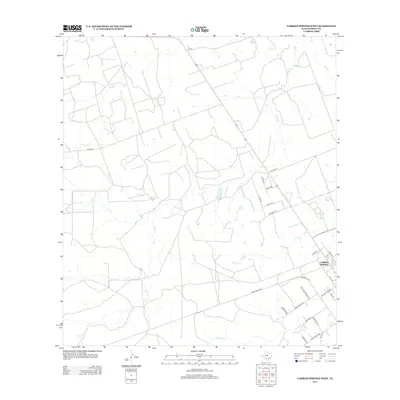
2013 Map of Carrizo Springs West
USGS Topo · Published 2013About this map
The western outskirts of Carrizo Springs are defined by a network of drainage systems and rural ranch roads in this South Texas landscape. Water sources like Peña Cr and Peñitas Cr meander across the plains, while Salt Cr and Rocky Cr provide further geographic markers for the region's topography. The infrastructure is characterized by an extensive grid of local transportation routes, including Farm Road 2367, Ranch Road 2644, and several family-named thoroughfares such as Devilbiss Country Rd, Arambula Rd, and Saenz Rd. This layout reflects the area's ongoing agricultural and ranching legacy, where property access and water rights have long dictated the movement across the Dimmit County terrain. Small connectors like Rodriguez Ln and Tocouliny Ln illustrate the fine-grain detail of local land divisions near the city limits.
Find a feature on this map
28 named features on this map. Tap any name to fly to it.
Don’t see what you’re looking for? This feature index may not catch every label — zoom into the map to look around manually.
Map Details
Editions of this 2013 Carrizo Springs West Map
This is the sole edition of this map. No revisions or reprints were ever made.
Other maps of this area

1929 · Cotulla
USGS Topo · 1:125,000

1939 · Carrizo Springs
USGS Topo · 1:62,500

1940 · Asherton
USGS Topo · 1:62,500

1940 · Cometa
USGS Topo · 1:62,500

1941 · Botella Creek
USGS Topo · 1:62,500

1953 · Crystal City
USGS Topo · 1:250,000

1955 · Crystal City
USGS Topo · 1:250,000

1957 · Botella Creek
USGS Topo · 1:62,500

1958 · Eagle Pass
USGS Topo · 1:250,000

1961 · Crystal City
USGS Topo · 1:250,000