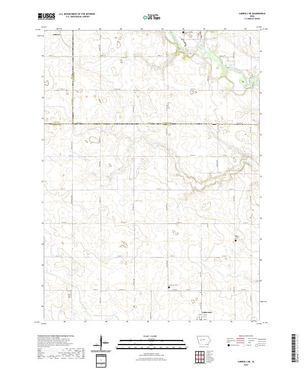
2022 Map of Carroll NE
USGS Topo · Published 2022About this map
Lidderdale and Auburn anchor this agricultural landscape along the intersection of Carroll, Calhoun, and Sac Counties. The terrain is defined by the winding course of the North Raccoon River and Lake Creek in the northeast, while several drainage features like Ditch Number 72 and 81 and Buck Run indicate a highly managed hydraulic environment typical of Iowa's prairie-pothole region converted to farmland. Family historians will find value in the placement of several rural burial sites, including Cottonwood Cem, East Liberty Cem, and Immanuel Cem, which serve as permanent markers of early township settlement. The grid of roads, such as Co RD e17 and Mahogany Ave, reveals the persistent structure of the Public Land Survey System across the rural townships of t85n r34w and its neighbors.
Find a feature on this map
50 named features on this map. Tap any name to fly to it.
Don’t see what you’re looking for? This feature index may not catch every label — zoom into the map to look around manually.
Map Details
Editions of this 2022 Carroll NE Map
This is the sole edition of this map. No revisions or reprints were ever made.
Other maps of this area

1954 · Fort Dodge
USGS Topo · 1:250,000

1957 · Fort Dodge
USGS Topo · 1:250,000

1958 · Fort Dodge
USGS Topo · 1:250,000
1980 · Glidden
USGS Topo · 1:24,000

1980 · Breda
USGS Topo · 1:24,000

1980 · Grant City
USGS Topo · 1:24,000

1980 · Carroll NE
USGS Topo · 1:24,000

1980 · Yetter
USGS Topo · 1:24,000
1980 · Carroll West
USGS Topo · 1:24,000
1980 · Carroll East
USGS Topo · 1:24,000