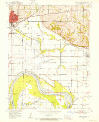
1951 Map of Carrollton East
USGS Topo · Published 1952About this map
Carrollton serves as the regional hub in this early 1950s survey, showing the intricate grid of the town center anchored by the Courthouse and the Post Office. The landscape is defined by the heavy infrastructure of the Atchison Topeka and Santa Fe and Wabash railroads, which converge near the river bottomlands. South of the main settlement, the terrain shifts into the fertile floodplains of the Missouri River, where Whites Island and Cranberry Chute illustrate the complex hydrology of the river's path. Rural life is well-documented through a high density of local institutions, including Dietrich Sch, Mayview Sch, and Wakenda Ch. The map provides a detailed view of the transition from the bluffs at Shields Hill down to the creek-fed lowlands of Little Wakenda Creek, showing how historical settlement followed the higher ground and rail corridors.
Find a feature on this map
37 named features on this map. Tap any name to fly to it.
Don’t see what you’re looking for? This feature index may not catch every label — zoom into the map to look around manually.
Map Details
Editions of this 1951 Carrollton East Map
4 editions found
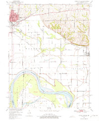

Other maps of this area

1889 · Lexington
USGS Topo · 1:125,000

1890 · Marshall
USGS Topo · 1:125,000

1892 · Marshall
USGS Topo · 1:125,000

1901 · Marshall
USGS Topo · 1:125,000

1951 · Bosworth
USGS Topo · 1:24,000

1951 · Miami Station
USGS Topo · 1:24,000

1951 · Carrollton East
USGS Topo · 1:24,000
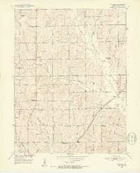
1951 · Standish
USGS Topo · 1:24,000

1951 · Waverly
USGS Topo · 1:24,000

1953 · Moberly
USGS Topo · 1:250,000