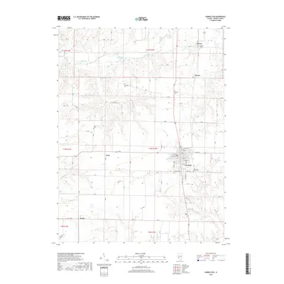
2018 Map of Carrollton
USGS Topo · Published 2018About this map
The county seat of Carrollton serves as the primary hub of this Greene County landscape, where the street grid meets the agricultural reaches of the Illinois prairie. To the north, Apple Creek and its tributary Coates Cr wind through the terrain, creating a natural bypass for the small rail-side settlements of Berdan and Pegram. The map reveals a high concentration of rural burial sites, including the Pinkerton Number 1 Cem and the centrally located Hopewell Cem, which provide significant value for genealogists tracing local family histories. Smaller communities like Kaser and Woody are scattered along the section lines, while the Saint Johns Catholic Cem stands as a prominent landmark on the outskirts of the main town. The drainage patterns of Hurricane Cr and Link Br define the southwestern quadrant, illustrating how the local hydrology influenced the placement of farms and early homesteads.
Find a feature on this map
42 named features on this map. Tap any name to fly to it.
Don’t see what you’re looking for? This feature index may not catch every label — zoom into the map to look around manually.
Map Details
Editions of this 2018 Carrollton Map
This is the sole edition of this map. No revisions or reprints were ever made.
Other maps of this area

1924 · Roodhouse
USGS Topo · 1:62,500

1926 · Roodhouse
USGS Topo · 1:62,500

1930 · Pearl
USGS Topo · 1:62,500

1930 · Hardin
USGS Topo · 1:62,500

1930 · Jerseyville
USGS Topo · 1:62,500

1933 · Jerseyville
USGS Topo · 1:62,500

1934 · Hardin
USGS Topo · 1:62,500

1938 · Hardin
USGS Topo · 1:62,500

1948 · Quincy
USGS Topo · 1:250,000

1950 · Pearl
USGS Topo · 1:62,500