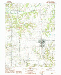
1983 Map of Carrollton
USGS Topo · Published 1984About this map
The county seat of Carrollton dominates this 1983 survey, situated at the crossroads of several major regional routes and the Illinois Central Gulf railroad. The town center is clearly defined by the Courthouse and Po, while surrounding neighborhoods include High Sch and St Johns Sch. This landscape reflects a deep history of rural settlement and agriculture, characterized by numerous family and community burial grounds such as Pinkerton Cem, Hopewell Cem, and Elmdale Cem.
Find a feature on this map
37 named features on this map. Tap any name to fly to it.
Don’t see what you’re looking for? This feature index may not catch every label — zoom into the map to look around manually.
Map Details
Editions of this 1983 Carrollton Map
This is the sole edition of this map. No revisions or reprints were ever made.
Other maps of this area

1924 · Roodhouse
USGS Topo · 1:62,500

1926 · Roodhouse
USGS Topo · 1:62,500

1930 · Pearl
USGS Topo · 1:62,500

1930 · Hardin
USGS Topo · 1:62,500

1930 · Jerseyville
USGS Topo · 1:62,500

1933 · Jerseyville
USGS Topo · 1:62,500

1934 · Hardin
USGS Topo · 1:62,500

1938 · Hardin
USGS Topo · 1:62,500

1948 · Quincy
USGS Topo · 1:250,000

1950 · Pearl
USGS Topo · 1:62,500