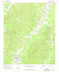
1967 Map of Carrollton
USGS Topo · Published 1968About this map
Carrollton serves as the focal point of this Pickens County landscape, situated where local roads converge near the southern edge of the survey. The town's grid is clearly defined, featuring a central square and a nearby water tank and lookout tower. Northward, the Alabama and Tennessee Northern railroad cuts a diagonal path through the terrain, connecting the smaller community of Stansel to the more developed hub of Reform. This rail corridor mirrors the natural drainage patterns of Lubbub Creek and its many tributaries.
Find a feature on this map
31 named features on this map. Tap any name to fly to it.
Don’t see what you’re looking for? This feature index may not catch every label — zoom into the map to look around manually.
Map Details
Editions of this 1967 Carrollton Map
3 editions found
Other maps of this area

1953 · Birmingham
USGS Topo · 1:250,000

1953 · West Point
USGS Topo · 1:250,000

1956 · Birmingham
USGS Topo · 1:250,000

1957 · Birmingham
USGS Topo · 1:250,000

1958 · West Point
USGS Topo · 1:250,000

1963 · West Point
USGS Topo · 1:250,000

1966 · Ethelsville
USGS Topo · 1:24,000

1966 · Reform SW
USGS Topo · 1:24,000

1967 · Carrollton
USGS Topo · 1:24,000

1967 · Gordo
USGS Topo · 1:24,000