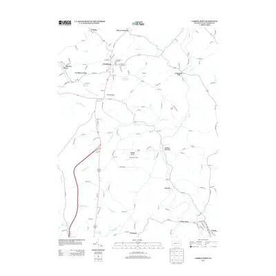
2013 Map of Carrolltown
USGS Topo · Published 2013About this map
Carrolltown occupies a prominent position in this part of Cambria County, situated atop the Dividing Ridge which separates major drainages of the eastern United States. This hydrological divide is marked by the presence of the W Br Susquehanna River flowing north and west, while the N Br Blacklick Cr and S Br Blacklick Cr drain toward the southwest. The map documents a landscape of small rural settlements and crossroad hamlets, including Bradley Junction, Eckenrode Mill, and Bakers Crossroad. Transportation and utility infrastructure are represented by features such as Tunnel Siding, Strittmatter Airport, and several water management sites like the Carrolltown Reservoir and City Reservoir. The southern edge of the survey reaches the borough of Loretto, providing a detailed look at the local road network and land divisions in the early 21st century.
Find a feature on this map
141 named features on this map. Tap any name to fly to it.
Don’t see what you’re looking for? This feature index may not catch every label — zoom into the map to look around manually.
Map Details
Editions of this 2013 Carrolltown Map
This is the sole edition of this map. No revisions or reprints were ever made.
Other maps of this area

1902 · Ebensburg
USGS Topo · 1:62,500

1902 · Patton
USGS Topo · 1:62,500

1902 · Barnesboro
USGS Topo · 1:62,500

1904 · Barnesboro
USGS Topo · 1:62,500

1904 · Patton
USGS Topo · 1:62,500

1904 · Ebensburg
USGS Topo · 1:62,500

1904 · Johnstown
USGS Topo · 1:62,500

1907 · Johnstown
USGS Topo · 1:62,500

1943 · Punxsutawney
USGS Topo · 1:125,000

1953 · Pittsburgh
USGS Topo · 1:250,000