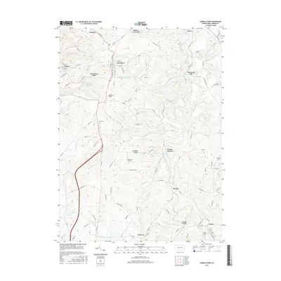
2016 Map of Carrolltown
USGS Topo · Published 2016About this map
Carrolltown and Loretto anchor this mid-2010s survey of the Alleghenies, where the landscape is defined by the high ground of Dividing Ridge and the winding course of Chest Creek. The area’s character is a blend of academic tradition at Saint Francis Univ, rural crossroads like Bakers Crossroad, and industrial history suggested by the name Eckenrode Mill. Water management is prominent through features like the Carrolltown Reservoir, Bakerton Reservoir, and City Reservoir Number Two, which serve the clustered settlements along the primary north-south corridors. In the south, smaller hamlets such as Driscoll and Winterset line the roads leading toward Loretto Road, while localized aviation is represented by Strittmatter Airport and Strohmier Airport. This map captures a modern view of a region where the geography of the Susquehanna and Blacklick Creek headwaters has long dictated the placement of roads and towns.
Find a feature on this map
114 named features on this map. Tap any name to fly to it.
Don’t see what you’re looking for? This feature index may not catch every label — zoom into the map to look around manually.
Map Details
Editions of this 2016 Carrolltown Map
This is the sole edition of this map. No revisions or reprints were ever made.
Other maps of this area

1902 · Ebensburg
USGS Topo · 1:62,500

1902 · Patton
USGS Topo · 1:62,500

1902 · Barnesboro
USGS Topo · 1:62,500

1904 · Barnesboro
USGS Topo · 1:62,500

1904 · Patton
USGS Topo · 1:62,500

1904 · Ebensburg
USGS Topo · 1:62,500

1904 · Johnstown
USGS Topo · 1:62,500

1907 · Johnstown
USGS Topo · 1:62,500

1943 · Punxsutawney
USGS Topo · 1:125,000

1953 · Pittsburgh
USGS Topo · 1:250,000