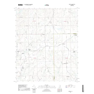
2018 Map of Carrville
USGS Topo · Published 2018About this map
Reeltown and Tallapoosa City anchor this landscape along the county line between Tallapoosa and Macon. The terrain is defined by a dense network of watercourses including Sougahatchee Creek in the north and the winding Stone Creek and Mill Creek to the south. Local history is preserved in several small burial grounds such as Reeltown Cemetery, Liberty Cemetery, and Woodland Cemetery, which serve as markers for the scattered rural communities.
Find a feature on this map
98 named features on this map. Tap any name to fly to it.
Don’t see what you’re looking for? This feature index may not catch every label — zoom into the map to look around manually.
Map Details
Editions of this 2018 Carrville Map
This is the sole edition of this map. No revisions or reprints were ever made.
Other maps of this area

1906 · Dadeville
USGS Topo · 1:125,000

1955 · Phenix City
USGS Topo · 1:250,000

1957 · Phenix City
USGS Topo · 1:250,000

1958 · Phenix City
USGS Topo · 1:250,000

1971 · Ponders
USGS Topo · 1:24,000

1971 · Carrville
USGS Topo · 1:24,000
1971 · Tallassee
USGS Topo · 1:24,000

1971 · Tuskegee
USGS Topo · 1:24,000

1971 · Shorter
USGS Topo · 1:24,000

1971 · Thornton
USGS Topo · 1:24,000