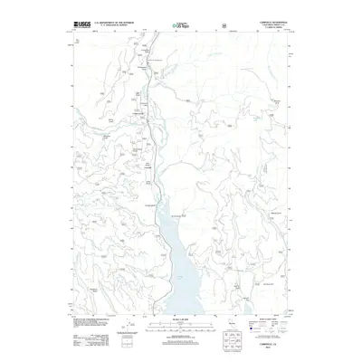
2012 Map of Carrville
USGS Topo · Published 2012About this map
Carrville and Coffee Creek serve as the primary hubs in this mountainous region of Trinity County, where the Trinity River feeds into the northern reaches of Trinity Lake. The landscape is defined by a dense network of gulches and ridges, with drainage provided by numerous named creeks including Buckeye Cr, Copper Cr, and Coffee Cr. Higher elevations are marked by landmarks like Billys Peak Lookout and Bonanza King, reflecting the area's history of resource extraction and fire surveillance. The survey details a mix of forest service infrastructure and small settlements, with residential and recreational sites such as Oneeyed Flat, Squirrel Flat, and the Trinity River Campground situated along the valley floors. Transport into the backcountry is managed via specialized routes like Billys Peak Rd and Coffee Creek Rd, which navigate the steep terrain between Rancheria Ridge and Plummer Hill.
Find a feature on this map
72 named features on this map. Tap any name to fly to it.
Don’t see what you’re looking for? This feature index may not catch every label — zoom into the map to look around manually.
Map Details
Editions of this 2012 Carrville Map
This is the sole edition of this map. No revisions or reprints were ever made.
Other maps of this area

1886 · Shasta
USGS Topo · 1:250,000

1890 · Red Bluff
USGS Topo · 1:250,000

1894 · Red Bluff
USGS Topo · 1:250,000

1894 · Shasta
USGS Topo · 1:250,000

1913 · Weaverville
USGS Topo · 1:125,000

1923 · Sawyers Bar
USGS Topo · 1:125,000

1931 · Etna
USGS Topo · 1:96,000

1934 · Etna
USGS Topo · 1:125,000

1948 · Weed
USGS Topo · 1:250,000

1950 · Weed
USGS Topo · 1:250,000