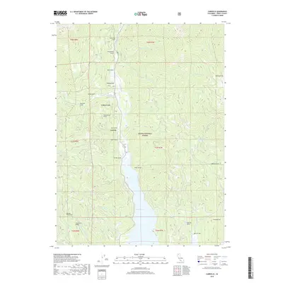
2018 Map of Carrville
USGS Topo · Published 2018About this map
Trinity Lake dominates the southern half of this 2018 survey, reflecting the modern geography of this mountain region within the Shasta National Forest. The map documents the northern reaches of the reservoir where the Trinity River feeds into the basin, creating a distinct shoreline landscape below the high peaks of the Salmon Mountains. Small settlements and landmarks such as Carrville, Coffee Creek, and Oneeyed Flat remain situated along the river corridor, preserving the names of the area's pioneer and mining history.
Find a feature on this map
45 named features on this map. Tap any name to fly to it.
Don’t see what you’re looking for? This feature index may not catch every label — zoom into the map to look around manually.
Map Details
Editions of this 2018 Carrville Map
This is the sole edition of this map. No revisions or reprints were ever made.
Other maps of this area

1886 · Shasta
USGS Topo · 1:250,000

1890 · Red Bluff
USGS Topo · 1:250,000

1894 · Red Bluff
USGS Topo · 1:250,000

1894 · Shasta
USGS Topo · 1:250,000

1913 · Weaverville
USGS Topo · 1:125,000

1923 · Sawyers Bar
USGS Topo · 1:125,000

1931 · Etna
USGS Topo · 1:96,000

1934 · Etna
USGS Topo · 1:125,000

1948 · Weed
USGS Topo · 1:250,000

1950 · Weed
USGS Topo · 1:250,000