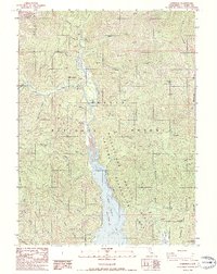
1986 Map of Carrville
USGS Topo · Published 1986About this map
Clair Engle Lake dominates the southern half of this landscape, marking a significant era of water management within the Whiskeytown - Shasta - Trinity National Recreation Area. The Trinity River feeds this reservoir, flowing south past small settlements like Carrville and Coffee Creek. The map documents a blend of public land use and remnant industrial activity, with several unnamed mines, a Mine Dump, and a Gravel Pit scattered among the gulches and flats. High-elevation landmarks such as Billys Peak in the Scott Mountains and Bonanza King rise above the drainage basins. Local history is preserved in features like the riverside Cem, the small cluster at One-eyed Flat, and the infrastructure of a Flume and Powerhouse Gulch, illustrating the region's reliance on both timber and water power.
Find a feature on this map
53 named features on this map. Tap any name to fly to it.
Don’t see what you’re looking for? This feature index may not catch every label — zoom into the map to look around manually.
Map Details
Editions of this 1986 Carrville Map
This is the sole edition of this map. No revisions or reprints were ever made.
Other maps of this area

1886 · Shasta
USGS Topo · 1:250,000

1890 · Red Bluff
USGS Topo · 1:250,000

1894 · Red Bluff
USGS Topo · 1:250,000

1894 · Shasta
USGS Topo · 1:250,000

1913 · Weaverville
USGS Topo · 1:125,000

1923 · Sawyers Bar
USGS Topo · 1:125,000

1931 · Etna
USGS Topo · 1:96,000

1934 · Etna
USGS Topo · 1:125,000

1948 · Weed
USGS Topo · 1:250,000

1950 · Weed
USGS Topo · 1:250,000