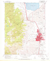
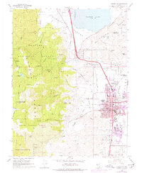
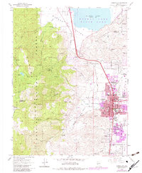
1968 Map of Carson City
USGS Topo · Published 1972About this map
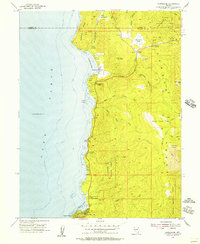
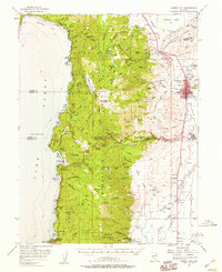
Carson City serves as the focal point of this Nevada survey, showing the capital's expansion at the foot of the Virginia Range during the late 1960s. The urban grid is densely packed with civic landmarks, including the Gov Mansion, the Museum, and the Armory, while the surrounding landscape transitions sharply from residential blocks to the steep canyons of the Toiyabe National Forest. The map documents the physical separation between the main city and the Carson Indian Colony to the south, as well as the prominence of the Lone Mtn Cemetery on the city's northern edge.
Find a feature on this map
78 named features on this map. Tap any name to fly to it.
Don’t see what you’re looking for? This feature index may not catch every label — zoom into the map to look around manually.
Map Details
Editions of this 1968 Carson City Map
3 editions found
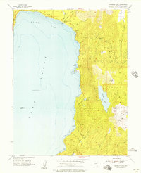
Other maps of this area

1891 · Carson
USGS Topo · 1:125,000

1893 · Carson
USGS Topo · 1:125,000

1950 · Virginia City
USGS Topo · 1:62,500

1950 · Mt. Rose
USGS Topo · 1:62,500

1952 · Mt. Rose
USGS Topo · 1:62,500

1952 · Virginia City
USGS Topo · 1:62,500
1955 · Marlette Lake
USGS Topo · 1:24,000
1955 · Glenbrook
USGS Topo · 1:24,000

1956 · Dayton
USGS Topo · 1:62,500
1956 · Carson City
USGS Topo · 1:62,500