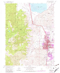
1968 Map of Carson City
USGS Topo · Published 1983About this map
Carson City sits at the foot of the Virginia Range and Toiyabe National Forest, showing a capital city in transition during the late 1960s with updates into the early 1980s. The urban grid is dense with institutional landmarks, including the Gov Mansion, the Museum, and numerous schools such as Fritsch Sch and St Theresa Sch. To the north, Washoe Lake State Park borders the high desert valley, while the western heights are defined by complex water management features like the Aqueduct, Siphon, and the Hobart Cr Reservoir. Local history is preserved at the Lone Mtn Cemetery and the Carson Indian Colony, while the industrial past is visible in the Old Railroad Grade and active extraction sites like the Premier Mine. This survey captures the intersection of civic expansion and the demanding geography of the Eagle Valley.
Find a feature on this map
75 named features on this map. Tap any name to fly to it.
Don’t see what you’re looking for? This feature index may not catch every label — zoom into the map to look around manually.
Map Details
Editions of this 1968 Carson City Map
3 editions found
Other maps of this area

1891 · Carson
USGS Topo · 1:125,000

1893 · Carson
USGS Topo · 1:125,000

1950 · Virginia City
USGS Topo · 1:62,500

1950 · Mt. Rose
USGS Topo · 1:62,500

1952 · Mt. Rose
USGS Topo · 1:62,500

1952 · Virginia City
USGS Topo · 1:62,500

1955 · Marlette Lake
USGS Topo · 1:24,000

1955 · Glenbrook
USGS Topo · 1:24,000

1956 · Dayton
USGS Topo · 1:62,500

1956 · Carson City
USGS Topo · 1:62,500