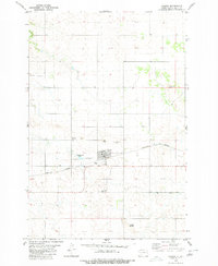
1980 Map of Carson
USGS Topo · Published 1980About this map
Carson serves as the focal point of this Grant County landscape, situated where the Burlington Northern railroad cuts through the high plains. The settlement shows its community character through the presence of an Athletic Field and a dedicated Rodeo Ground on the outskirts of the residential grid. Local history is anchored by Emmaus Cem to the northwest and Community Cem to the south, providing clear points for genealogical research. The surrounding terrain is defined by prominent elevations such as Carson Hill, Cookout Butte, and the Circle Buttes to the south. Antelope Creek winds through the northwestern corner, contrasting with the man-made infrastructure like the Water Tank and various well sites that supported the local ranching and agricultural economy during this era.
Find a feature on this map
14 named features on this map. Tap any name to fly to it.
Don’t see what you’re looking for? This feature index may not catch every label — zoom into the map to look around manually.
Map Details
Editions of this 1980 Carson Map
This is the sole edition of this map. No revisions or reprints were ever made.
Other maps of this area

1954 · Bismarck
USGS Topo · 1:250,000

1958 · Bismarck
USGS Topo · 1:250,000

1972 · Carson SE
USGS Topo · 1:24,000

1972 · Leith
USGS Topo · 1:24,000

1980 · Otter Creek West
USGS Topo · 1:24,000

1980 · Brisbane
USGS Topo · 1:24,000

1980 · Crown Butte Creek SE
USGS Topo · 1:24,000

1980 · Lark
USGS Topo · 1:24,000

1980 · Heil
USGS Topo · 1:24,000

1980 · Crown Butte Creek SW
USGS Topo · 1:24,000