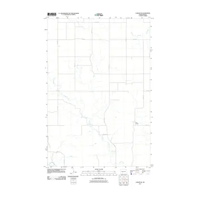
2011 Map of Carson SE
USGS Topo · Published 2011About this map
Boxelder Creek meanders through this section of Grant County, creating a complex drainage network that defines the rural prairie landscape. The watercourse dominates the central and southern portions of the map before nearing its confluence with the Cannonball River at the extreme southern border. This 2011 survey captures the area’s strictly organized section-line road system, where routes like 72nd St SW and 60th Ave SW impose a rigid grid over the undulating terrain. A significant point of local history is found at the Saint Vincent Cemetery, located in the southeastern quadrant along 78th St SW. In the northern reaches, the headwaters of Louise Creek provide additional drainage for this sparsely settled agricultural region, illustrating the enduring relationship between water access and land division in North Dakota.
Find a feature on this map
19 named features on this map. Tap any name to fly to it.
Don’t see what you’re looking for? This feature index may not catch every label — zoom into the map to look around manually.
Map Details
Editions of this 2011 Carson SE Map
This is the sole edition of this map. No revisions or reprints were ever made.
Other maps of this area

1954 · Bismarck
USGS Topo · 1:250,000

1958 · Bismarck
USGS Topo · 1:250,000

1972 · Carson SE
USGS Topo · 1:24,000

1972 · Leith
USGS Topo · 1:24,000

1972 · Paradise Flats
USGS Topo · 1:24,000

1972 · Wheeler Hills
USGS Topo · 1:24,000

1980 · Brisbane
USGS Topo · 1:24,000

1980 · Bell Coulee West
USGS Topo · 1:24,000

1980 · Lark
USGS Topo · 1:24,000

1980 · Heil
USGS Topo · 1:24,000