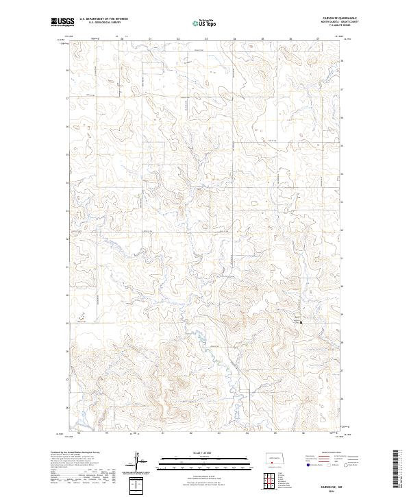
2024 Map of Carson SE
USGS Topo · Published 2024About this map
The Cannonball River meanders across the southern edge of this Grant County landscape, defining the local drainage system as it flows eastward. This rural corridor is characterized by the convergence of smaller watercourses, most notably Boxelder Creek, which carves through the undulating topography. The map illustrates a strictly organized grid of sectional roads, including 72nd St SW and 54th Ave SW, which facilitate movement between the agricultural parcels of this prairie region.
Find a feature on this map
20 named features on this map. Tap any name to fly to it.
Don’t see what you’re looking for? This feature index may not catch every label — zoom into the map to look around manually.
Map Details
Editions of this 2024 Carson SE Map
This is the sole edition of this map. No revisions or reprints were ever made.
Other maps of this area

1954 · Bismarck
USGS Topo · 1:250,000

1958 · Bismarck
USGS Topo · 1:250,000

1972 · Carson SE
USGS Topo · 1:24,000

1972 · Leith
USGS Topo · 1:24,000

1972 · Paradise Flats
USGS Topo · 1:24,000

1972 · Wheeler Hills
USGS Topo · 1:24,000

1980 · Brisbane
USGS Topo · 1:24,000

1980 · Bell Coulee West
USGS Topo · 1:24,000

1980 · Lark
USGS Topo · 1:24,000

1980 · Heil
USGS Topo · 1:24,000