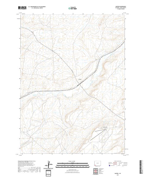
2021 Map of Carter
USGS Topo · Published 2021About this map
Carter sits at the center of this Wyoming high plains landscape, where the intersection of Co Rd 225 and Leroy Rd marks a historic hub of local travel in Uinta County. The terrain is defined by the winding course of Muddy Cr, which snakes through the township boundaries of T17N and T18N. To the south, the presence of the Fort Bridger Airport near the junction of Co Rd 230 indicates the area's role in regional aviation and logistics. Smaller waterways like Rock Cr and Spring Cr feed into the larger drainage system, illustrating the natural water patterns that have dictated ranching and settlement locations for generations. The map's layout of section lines and range markers provides a clear framework for researchers tracing specific land parcels and historical property boundaries in this part of the state.
Find a feature on this map
15 named features on this map. Tap any name to fly to it.
Don’t see what you’re looking for? This feature index may not catch every label — zoom into the map to look around manually.
Map Details
Editions of this 2021 Carter Map
This is the sole edition of this map. No revisions or reprints were ever made.
Other maps of this area

1954 · Ogden
USGS Topo · 1:250,000

1958 · Ogden
USGS Topo · 1:250,000

1960 · Ogden
USGS Topo · 1:250,000

1962 · Cumberland Gap
USGS Topo · 1:24,000

1964 · Fort Bridger
USGS Topo · 1:24,000

1964 · Carter
USGS Topo · 1:24,000

1964 · Mountain View
USGS Topo · 1:24,000

1964 · Austin Reservoir
USGS Topo · 1:24,000

1965 · Bridger
USGS Topo · 1:24,000

1965 · Leroy
USGS Topo · 1:24,000