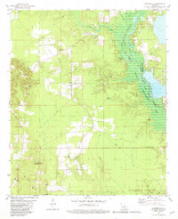
1981 Map of Carterville
USGS Topo · Published 1981About this map
Carterville and Redland anchor this rural landscape in Bossier Parish, where the local economy and geography are defined by the intensive development of energy resources. The terrain is crisscrossed by petroleum infrastructure, including the Redland Oil and Gas Field and the South Sarepta Oil and Gas Field, with numerous Oil Wells and Drill Holes dotting the hills. This industrial layer exists alongside traditional community markers like the Morning Star Ch and the Plain Dealing Lookout Tower.
Find a feature on this map
36 named features on this map. Tap any name to fly to it.
Don’t see what you’re looking for? This feature index may not catch every label — zoom into the map to look around manually.
Map Details
Editions of this 1981 Carterville Map
This is the sole edition of this map. No revisions or reprints were ever made.
Other maps of this area

1922 · Sarepta
USGS Topo · 1:62,500

1924 · Sarepta
USGS Topo · 1:62,500

1950 · Plain Dealing SW
USGS Topo · 1:31,680

1950 · Plain Dealing NE
USGS Topo · 1:31,680

1950 · Plain Dealing SE
USGS Topo · 1:31,680

1950 · Plain Dealing NW
USGS Topo · 1:31,680

1952 · Bradley
USGS Topo · 1:24,000

1952 · Bradley SE
USGS Topo · 1:24,000

1953 · Carterville
USGS Topo · 1:24,000

1953 · El Dorado
USGS Topo · 1:250,000