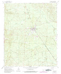
1965 Map of Carthage
USGS Topo · Published 1984About this map
The town of Carthage serves as the central hub of this Dallas County landscape, situated at the intersection of timber-rich wetlands and an established rail corridor. The Chicago Rock Island and Pacific railroad cuts a diagonal path through the terrain, passing through the heart of the settlement and driving the local economy. Waterways like Moro Creek and Tenmile Creek drain the surrounding woods, which are crisscrossed by a dense network of local roads including Banks Road and Tram Road, the latter suggesting a history of logging transport. Evidence of rural community life is scattered throughout the quadrangle, from the northern Mt Zion Ch and its adjacent Mt Zion Cem to the southern reach of Bethel Cem. Further south, the settlement of Boyd lies near the confluence of Pickett Creek and Moro Creek, while a Lookout Tower stands watch over the expansive Arkansas timberland.
Find a feature on this map
37 named features on this map. Tap any name to fly to it.
Don’t see what you’re looking for? This feature index may not catch every label — zoom into the map to look around manually.
Map Details
Editions of this 1965 Carthage Map
2 editions found
Other maps of this area

1903 · Camden
USGS Topo · 1:125,000

1953 · El Dorado
USGS Topo · 1:250,000

1955 · Little Rock
USGS Topo · 1:250,000

1956 · Little Rock
USGS Topo · 1:250,000

1957 · El Dorado
USGS Topo · 1:250,000

1958 · El Dorado
USGS Topo · 1:250,000

1960 · El Dorado
USGS Topo · 1:250,000

1960 · Little Rock
USGS Topo · 1:250,000

1964 · Little Rock
USGS Topo · 1:250,000

1964 · Bunn
USGS Topo · 1:24,000