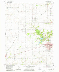
1974 Map of Carthage West
USGS Topo · Published 1978About this map
The county seat of Carthage anchors the eastern edge of this mid-1970s survey, showing a well-developed grid featuring the Courthouse, City Hall, and Robert Morris Jr College. The surrounding landscape of Rock Creek Prairie is defined by a dense network of transportation and rural community hubs. Two major rail lines, the Toledo Peoria and Western and the Norfolk and Western, intersect in the region, supporting small settlements like Ferris and McCall.
Find a feature on this map
40 named features on this map. Tap any name to fly to it.
Don’t see what you’re looking for? This feature index may not catch every label — zoom into the map to look around manually.
Map Details
Editions of this 1974 Carthage West Map
This is the sole edition of this map. No revisions or reprints were ever made.
Other maps of this area

1932 · Lomax
USGS Topo · 1:62,500

1933 · Carthage
USGS Topo · 1:62,500

1936 · Keokuk
USGS Topo · 1:62,500

1936 · Fort Madison
USGS Topo · 1:62,500

1937 · Carthage
USGS Topo · 1:62,500

1937 · Lomax
USGS Topo · 1:62,500

1950 · Keokuk
USGS Topo · 1:62,500

1958 · Burlington
USGS Topo · 1:250,000

1961 · Burlington
USGS Topo · 1:250,000

1963 · Burlington
USGS Topo · 1:250,000