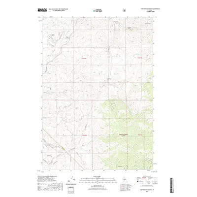
2020 Map of Cartwright Canyon
USGS Topo · Published 2020About this map
Boise National Forest lands dominate the southeastern corner of this landscape, where the terrain climbs toward the prominent landmark of Stack Rock. The map illustrates a transitional zone between the more developed areas along Crestview Dr and Loomis Airport in the west and the high, canyon-riven country of the backcountry. A dense network of modern recreational and access routes, including the Spring Valley Creek Trail, Baun's Eye Trail, and Knecht Loop Trail #7, crisscrosses the drainages of Spring Valley Cr and Shafer Cr. The boundary between Boise and Ada counties cuts diagonally through the southern sections, highlighting the proximity of these ridge-and-canyon systems to the expanding footprint of the nearby valley. Geographic landmarks like Bread Loaf Rock and Fiddleneck Ridge provide clear orientation points within this complex topography of Cartwright Canyon.
Find a feature on this map
75 named features on this map. Tap any name to fly to it.
Don’t see what you’re looking for? This feature index may not catch every label — zoom into the map to look around manually.
Map Details
Editions of this 2020 Cartwright Canyon Map
This is the sole edition of this map. No revisions or reprints were ever made.
Other maps of this area

1892 · Boise
USGS Topo · 1:125,000

1897 · Boise
USGS Topo · 1:125,000

1949 · Robie Creek
USGS Topo · 1:24,000

1953 · Eagle
USGS Topo · 1:24,000

1953 · Montour
USGS Topo · 1:62,500

1954 · Boise North
USGS Topo · 1:24,000

1954 · Boise
USGS Topo · 1:62,500

1955 · Boise
USGS Topo · 1:250,000

1957 · Cartwright Canyon
USGS Topo · 1:24,000

1957 · Horseshoe Bend
USGS Topo · 1:24,000