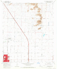
1965 Map of Casa Grande East
USGS Topo · Published 1967About this map
Casa Grande sits at the southwestern edge of this desert landscape, its grid showing significant mid-century development including the Evergreen Sch, Union High Sch, and a dedicated Athletic Field. The northeastern portion of the sheet is dominated by the topography of the Sacaton Mountains, where Signal Peak and Black Butte rise above the basin floor. The Gila River Indian Reservation Boundary cuts across the northern terrain, marking a distinct line between developed agricultural lands and the high desert.
Find a feature on this map
33 named features on this map. Tap any name to fly to it.
Don’t see what you’re looking for? This feature index may not catch every label — zoom into the map to look around manually.
Map Details
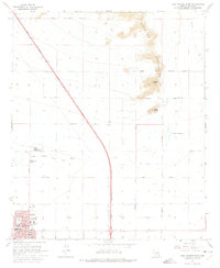
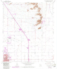
Editions of this 1965 Casa Grande East Map
3 editions found
Other maps of this area

1907 · Sacaton
USGS Topo · 1:62,500

1914 · Gila Butte
USGS Topo · 1:62,500

1917 · Gila Butte
USGS Topo · 1:62,500

1922 · Casa Grande
USGS Topo · 1:62,500

1922 · Signal Peak
USGS Topo · 1:62,500

1924 · Signal Peak
USGS Topo · 1:62,500

1924 · Casa Grande
USGS Topo · 1:62,500

1952 · Gila Butte SE
USGS Topo · 1:24,000

1952 · Gila Butte
USGS Topo · 1:62,500

1954 · Mesa
USGS Topo · 1:250,000