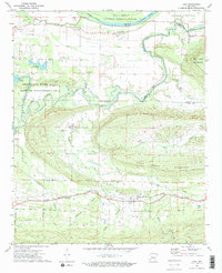
1972 Map of Casa
USGS Topo · Published 1974About this map
The Chicago Rock Island and Pacific railroad forms a primary east-west corridor through this section of the Arkansas River valley in the early 1970s, anchoring the community of Casa. To the north, the Petit Jean River meanders toward its confluence with the Arkansas, defining the Petit Jean River State Wildlife Management Area and the southern edge of the Holla Bend National Wildlife Refuge. The landscape is a mix of agricultural river bottoms like Carden Bottom and the rising elevations of Cove Mountain and Rose Creek Mountain. Small rural centers and named crossings such as Cotton Town, New Neely, and Slaty Crossing illustrate the distributed settlement patterns of Yell and Perry counties. Local history is preserved in landmarks like Harris Cem and Hickory Grove Ch, while several Gravel Pits and a Shale Pit mark the era's local extractive activity.
Find a feature on this map
45 named features on this map. Tap any name to fly to it.
Don’t see what you’re looking for? This feature index may not catch every label — zoom into the map to look around manually.
Map Details
Editions of this 1972 Casa Map
2 editions found
Other maps of this area

1888 · Dardanelle #4
USGS Topo · 1:62,500

1889 · Morrilton No. 3
USGS Topo · 1:62,500

1890 · Benton
USGS Topo · 1:125,000

1890 · Hot Springs
USGS Topo · 1:125,000

1890 · Dardanelle
USGS Topo · 1:125,000

1892 · Morrillton
USGS Topo · 1:125,000

1894 · Morrillton
USGS Topo · 1:125,000

1894 · Hot Springs
USGS Topo · 1:125,000

1894 · Benton
USGS Topo · 1:125,000

1955 · Little Rock
USGS Topo · 1:250,000