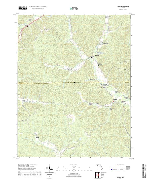
2021 Map of Cascade
USGS Topo · Published 2021About this map
The Saint Francois Mountains anchor the northwestern corner of this landscape, where the headwaters of several branches of Big Cr begin their descent through deep hollows. Small agricultural and timber settlements like Buckhorn, Gravelton, and Cascade are established along the valley floors, connected by a network of county roads and state highways that follow the natural contours of the Ozark Plateau. The area is marked by a high density of small family burial grounds, including the Huffman - McKelvey Cem and Dixon - Sutton Cem, indicating a long history of family-based land ownership.
Find a feature on this map
77 named features on this map. Tap any name to fly to it.
Don’t see what you’re looking for? This feature index may not catch every label — zoom into the map to look around manually.
Map Details
Editions of this 2021 Cascade Map
This is the sole edition of this map. No revisions or reprints were ever made.
Other maps of this area

1930 · Coldwater
USGS Topo · 1:62,500

1933 · Marquand
USGS Topo · 1:62,500

1934 · Greenville
USGS Topo · 1:62,500

1935 · Zalma
USGS Topo · 1:62,500

1938 · Marquand
USGS Topo · 1:62,500

1939 · Greenville
USGS Topo · 1:62,500

1939 · Zalma
USGS Topo · 1:62,500

1949 · Rolla
USGS Topo · 1:250,000

1949 · Coldwater
USGS Topo · 1:62,500

1953 · Rolla
USGS Topo · 1:250,000