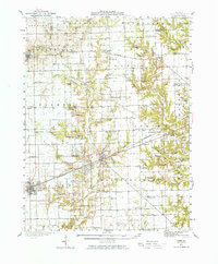
1942 Map of Casey
USGS Topo · Published 1976About this map
The Embarras River and its numerous tributaries, including Bluegrass Creek and Slater Creek, define the landscape of Clark and Edgar Counties during the early 1940s. A dense network of one-room schoolhouses such as Abraham Lincoln Sch, Germany Sch, and Mikes Peak Sch highlights the rural educational infrastructure of the period. The town of Martinsville serves as a central hub, where the Pennsylvania railroad line intersects with the local road system, adjacent to a significant Tank Farm and the Connelly Cem.
Find a feature on this map
95 named features on this map. Tap any name to fly to it.
Don’t see what you’re looking for? This feature index may not catch every label — zoom into the map to look around manually.
Map Details
Editions of this 1942 Casey Map
2 editions found
Other maps of this area

1932 · Marshall
USGS Topo · 1:62,500

1933 · Toledo
USGS Topo · 1:62,500

1936 · Oakland
USGS Topo · 1:48,000

1936 · Casey
USGS Topo · 1:48,000

1937 · Marshall
USGS Topo · 1:62,500

1938 · Toledo
USGS Topo · 1:62,500

1940 · Greenup
USGS Topo · 1:62,500

1942 · Oakland
USGS Topo · 1:62,500

1942 · Casey
USGS Topo · 1:62,500

1943 · Greenup
USGS Topo · 1:62,500