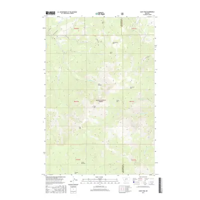
2017 Map of Casey Peak
USGS Topo · Published 2017About this map
The Elkhorn Mountains dominate this high-elevation landscape within the Helena National Forest, straddling the border between Jefferson and Broadwater counties. This 2017 survey shows a complex network of high mountain meadows and basins, including Casey Meadows, Horsethief Park, and Sheep Park, which are tucked between prominent summits like Casey Peak and High Peak. The drainage patterns are clearly defined by the headwaters of McClellan Creek, Crystal Creek, and Beaver Creek, reflecting the rugged watershed management of central Montana. Access to these remote elevations is limited to corridors like McClellan Creek Rd and Pole Creek Rd, illustrating the intersection of modern forest management and historical wilderness. Features such as Corral Mtn and the curiosly named Airplane Park suggest a long history of local use, from grazing to emergency aviation landmarks.
Find a feature on this map
36 named features on this map. Tap any name to fly to it.
Don’t see what you’re looking for? This feature index may not catch every label — zoom into the map to look around manually.
Map Details
Editions of this 2017 Casey Peak Map
This is the sole edition of this map. No revisions or reprints were ever made.
Other maps of this area

1886 · Fort Logan
USGS Topo · 1:250,000

1899 · Helena
USGS Topo · 1:62,500

1948 · White Sulphur Springs
USGS Topo · 1:250,000

1950 · Canyon Ferry
USGS Topo · 1:62,500

1950 · Townsend
USGS Topo · 1:62,500

1950 · East Helena
USGS Topo · 1:62,500

1950 · Clancy
USGS Topo · 1:62,500

1958 · White Sulphur Springs
USGS Topo · 1:250,000

1961 · White Sulphur Springs
USGS Topo · 1:250,000

1965 · White Sulphur Springs
USGS Topo · 1:250,000