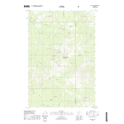
2020 Map of Casey Peak
USGS Topo · Published 2020About this map
The Elkhorn Mountains define this high-elevation landscape within the Helena National Forest, centered on the prominent Casey Peak. This area in Jefferson and Broadwater counties is characterized by a series of high parks and meadows, including Montgomery Park, Horsethief Park, and the lower Elk Park. The drainage pattern is complex, with McClellan Creek flowing to the west while Beaver Creek and Jackson Creek carve deep valleys through the eastern slopes. Evidence of land use is visible in the network of forest roads like Pole Creek Rd and Crystal Creek Rd, accessing higher elevations like High Peak. The curiously named Airplane Park and Casey Meadows suggest a long history of local use within this mountain range, which serves as a significant watershed for the region's downstream communities.
Find a feature on this map
46 named features on this map. Tap any name to fly to it.
Don’t see what you’re looking for? This feature index may not catch every label — zoom into the map to look around manually.
Map Details
Editions of this 2020 Casey Peak Map
This is the sole edition of this map. No revisions or reprints were ever made.
Other maps of this area

1886 · Fort Logan
USGS Topo · 1:250,000

1899 · Helena
USGS Topo · 1:62,500

1948 · White Sulphur Springs
USGS Topo · 1:250,000

1950 · Canyon Ferry
USGS Topo · 1:62,500

1950 · Townsend
USGS Topo · 1:62,500

1950 · East Helena
USGS Topo · 1:62,500

1950 · Clancy
USGS Topo · 1:62,500

1958 · White Sulphur Springs
USGS Topo · 1:250,000

1961 · White Sulphur Springs
USGS Topo · 1:250,000

1965 · White Sulphur Springs
USGS Topo · 1:250,000