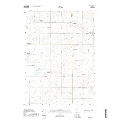
2019 Map of Casnovia
USGS Topo · Published 2019About this map
Casnovia sits at the intersection of Muskegon, Kent, and Ottawa counties, anchoring a landscape defined by its agricultural layout and small crossroads settlements. This 2019 survey captures the area's rural character, showing the established communities of Kent City and Canada Corners. The terrain is marked by an extensive drainage network, including N Br Crockery Cr and Rio Grande Cr, which feed into local basins such as Crockery Lake. For genealogists, the map is particularly detailed regarding burial grounds, recording several named sites including Hilton Cem, South Casnovia Cem, and Saint Francis Xavier's Cem. The grid of secondary roads like Kenowa Ave NW and Fruit Ridge Ave illustrates the enduring section-line infrastructure of West Michigan's orchard and farm country, while the smaller hamlet of Harrisburg remains a distinct point of interest in the western portion of the quadrangle.
Find a feature on this map
70 named features on this map. Tap any name to fly to it.
Don’t see what you’re looking for? This feature index may not catch every label — zoom into the map to look around manually.
Map Details
Editions of this 2019 Casnovia Map
This is the sole edition of this map. No revisions or reprints were ever made.
Other maps of this area

1918 · Cedar Springs
USGS Topo · 1:62,500

1943 · Cedar Springs
USGS Topo · 1:62,500

1945 · Ravenna
USGS Topo · 1:62,500

1954 · Midland
USGS Topo · 1:250,000

1958 · Midland
USGS Topo · 1:250,000

1958 · Sand Lake
USGS Topo · 1:62,500

1958 · Fremont
USGS Topo · 1:62,500

1959 · Midland
USGS Topo · 1:250,000

1966 · Midland
USGS Topo · 1:250,000

1967 · Sparta
USGS Topo · 1:24,000