
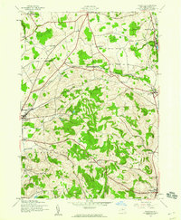
1943 Map of Cassville
USGS Topo · Published 1960About this map
Clayville and Cassville sit as primary hubs along the valley of Sauquoit Creek, where the Delaware Lackawanna and Western railroad dictates the local industrial corridor during the early 1940s. This survey, conducted by the Army Corps of Engineers and the USGS, documents a landscape of rolling dairy country and steep ridges defined by Tassel Hill and Hardscrabble Hill.
Find a feature on this map
40 named features on this map. Tap any name to fly to it.
Don’t see what you’re looking for? This feature index may not catch every label — zoom into the map to look around manually.
Map Details
Editions of this 1943 Cassville Map
2 editions found
Other maps of this area

1895 · Oriskany
USGS Topo · 1:62,500

1898 · Utica
USGS Topo · 1:62,500

1898 · Oriskany
USGS Topo · 1:62,500

1900 · Utica
USGS Topo · 1:62,500

1907 · Winfield
USGS Topo · 1:62,500

1907 · Sangerfield
USGS Topo · 1:62,500

1943 · Utica East
USGS Topo · 1:24,000

1943 · Hubbardsville
USGS Topo · 1:24,000

1943 · Unadilla Forks
USGS Topo · 1:24,000

1943 · Sangerfield
USGS Topo · 1:62,500