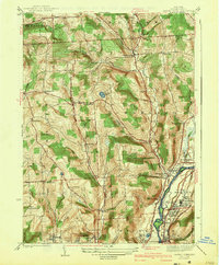
1942 Map of Castle Creek
USGS Topo · Published 1942About this map
The Chenango River valley serves as a primary corridor for settlement and industry north of Binghamton in the years leading into the Second World War. This survey reveals a dense concentration of religious and community sites, particularly near Hillcrest and Hinmanville, where the B'nai B'rith Cemeteries and Camp Meeting Grounds are established. To the west, the landscape transitions into upland terrain defined by agricultural enclaves like New Ireland and West Chenango. Educational life is well-documented through numerous rural institutions such as Dimmock Sch and Lilly Sch. The rail infrastructure is prominent along the riverbank, featuring the Erie RR and Delaware and Hudson RR, which connected these valley communities to the regional industrial hubs of Johnson City and Port Dickinson.
Find a feature on this map
55 named features on this map. Tap any name to fly to it.
Don’t see what you’re looking for? This feature index may not catch every label — zoom into the map to look around manually.
Map Details
Editions of this 1942 Castle Creek Map
3 editions found

Other maps of this area

1901 · Apalachin
USGS Topo · 1:62,500

1903 · Harford
USGS Topo · 1:62,500

1904 · Binghamton
USGS Topo · 1:62,500

1904 · Greene
USGS Topo · 1:62,500

1904 · Apalachin
USGS Topo · 1:62,500

1906 · Catatonk
USGS Topo · 1:125,000

1934 · Castle Creek
USGS Topo · 1:24,000

1935 · Binghamton West
USGS Topo · 1:24,000

1935 · Chenango Forks
USGS Topo · 1:24,000

1937 · Binghamton East
USGS Topo · 1:24,000